I've always been a big fan of publishing public information, particularly crime stats, location of sex offenders etc... up here in conservative Canada the rights of the criminals far outweigh those of the citizens so we don't have access to any of that information. A recent news announcement has featured yet another story about the Piedmont Police Department who has relaunched the interactive crime statistics feature on the city's Web site, enabling residents to gain information about major offenses in their neighborhood. The city's Web site is http://www.ci.piedmont.ca.us/. - You Google map hack fans out there will also be interested in the hack that I featured in our constantly growing Google Map Hack piece. The site uses the Google map API to track and locate sex offenders in Florida... very nice.. if I was moving into a new area I would definitely want this info.. kudos! Florida Sexual Predators - http://www.floridasexualpredator.com/ - A fantastic idea that really drives home to visitors the areas where sexual predators are living. The site conveniently displays a push-pin at the address of all known sex offenders in Florida. Search by Zip code and the display gets updated. Click on the pin and a pop-up window reveals a picture of the offender, information about him/her and a direct link is provided to the FDLE database. More on this and other maphacks at http://www.gisuser.com/content/view/5807/28/

July 15, 2005
July 12, 2005
Do you see a business model in Google Earth?
I've heard a bit of musing lately weather there's a clear business model in Google maps and Google Earth. Well, I have an opinion on this, although I'm not going to jump into that right now. I'm more curious as to what you think? To get it rolling... obviously Google can take risks, therefore they will... that's what breeds innovation. Right now the focus is on getting the developer community to embrace the applications and the APIs and they are. Mainstream users are being encouraged to grab the free viewer (and even upgrade to the pro version) and they are. Obviously in time commercial add ons will be available as will the addition of commercial dataset plug-ins and just you wait... do you think advertising will pop up in your Google Earth viewer? Imagine as you fly over your location and cruise along 5th Street... up pops a message that points to a nearby coffee shop that is displayed on your map.... that's just once scenario. What's your take?
Geocaching leads to spatial analysis in schools
An article on eSchool news geared towards educators puts things in a very clear perspective.. the main reason why most schools buy a GPS and get involved in spatial analysis is geocaching. Makes sense... and its also a great way to trigger the interest of teachers and students alike. Generally, most geocachers will find that once they get into it they will want to accomplish more.. that eventually leads to downloading a GIS viewer such as ArcExplorer and now, Google Earth. Throw in a bit of XML code and imagine what elementary and secondary school students are going to be coming up with in the next year or two! I'm looking forward to some of the GIS day stories already! For more info on these topics check out the following leads: http://www.gisday.com http://www.esri.com/software/arcexplorer/ http://www.geocaching.com/ http://kangis.org/
(Source of inspiration for this piece: http://www.eschoolnews.com/eti/2005/07/001019.php)
US Patent on Real Estate Search and Location System
Ok.. Here's an interesting one for any of you developers creating apps that drill down to more detailed imagery and provide solutions for locating real estate. Turns out that a 1991 patent covers off that technology and as a result some legal action is being taken against a real estate agent. Imagine if this one flies? Do you realize how many real estate agents have implemented similar functionality into their website? What about companies like RealBird who also have commercial products based on the same premise? Details of the patent are below:
The U.S. Patent (No. 5,032,989), "Real Estate Search and Location System and Method," was granted by the U.S. Patent and Trademark Office in 1991, at a time when the commercial use of the Internet was in its infancy. It covers a mapping system "for locating available real estate properties for sale, lease or rental using a database of available properties at a central location and remote stations which use a graphic interface," according to the document. The patent also includes a "drilldown" feature, under which specific areas can be displayed in greater detail -- The PR is also listed in detail here http://www.gisuser.com/content/view/6274/
What's your take on this? Imagine holding a patent on searching for hotels, parks, or ??? Seems kind of crazy if you ask me
Cheers... Glenn
G.I.S... 3 letters, hundreds of uses!
Just this AM I've run across a couple of new uses for the acronym G.I.S... how's this for some innovative uses of the term -
GIS - The Geoscape Intelligence System (GIS) offers signal coverage contours overlaid onto the most current and in- depth multicultural geo-demographic data for over 14,000 radio stations. Think of it as a market research tool.
Global Inspection Services (GIS) - Produce Safety & Security International, Inc offers truck sanitization operation (SOP) which consists of an Ozone and Spherequat 6400 mixture, under high pressure, to wash the inside and the outside of trailers. Upon completion the truck is given a GIS!
I'm sure there's hundreds of other uses for the term but realistically, don't you think our industry has pretty much laid claim to it? Got any other uses for the acronym... feel free to comment
July 11, 2005
Upload photo and comments to blogger via flickr
Upload photo and comments to blogger via flickr
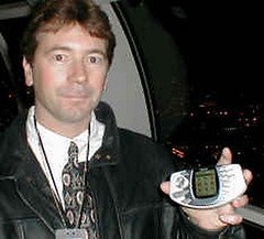
Originally uploaded by gisuser.
One more test here.. sorry! Someone recently asked how the email upload
to the blog is going.. all I can say is that its sweet! Now I can send
via a mobile device (my phone or a PDA while I've got Wi-Fi connection
at an airport or a starbucks) but I can't attach a photo/image. No
problemo though as flickr has the solution. I can now easily upload a
photo to my flickr blog via email and attach an image with comments and
a title. Adding to this, I can also have flickr route the post directly
to this blog on blogger as well.. How sweet is that? Attached with this
post is a shot of me showing off my N-Gage which was unfortunately
stolen from my car the ONE time I left it unlocked! I'm still on the
hunt for the punks that took it! Later... Glenn
Some wireless cell plan advice for you canucks going to the US
In preparing to jet away to San Diego again for this years' ESRI UC I decided to make a smart move and pre-purchase some airtime to get a bit of relief on the long distance calls to my cell. Any other Canadians may also wish to look at this to save some coin. If you don't travel or chat much on your cell then you likely don't know what I mean, however, if you've ever come back to a $300 bill just for less than 60 minutes of talking on your cell then you can relate. Some advice.. I'm on a Rogers GSM plan and can prepurchase blocks of 60 minutes for about $40.. 120 minutes for $60... the downside... there's still charges from the roaming provider, so if I'm roaming to AT&T they will be billing me about $1.20 a minute. So... 2 other alternatives are as follows... get a Sim card and pre-paid account from a US carrier like AT&T (I really should do this anyway as I'm in the US roaming a fair bit). The other alternative is to get people to text me instead! When I wear my other hat and attend Nokia and other "wireless" functions as part of managing SymbianOne.com, everyone uses MMS or txt messaging. Unfortunately nobody else in Canada or the US seems comfortable with it... too bad.
Subscribe to:
Posts (Atom)