 Have you explored some of the imagery available from GeoEye? The company is currently remembering the events of 9/11 by featuring scenes captured using the IKONOS satellite. Recall, at that time, because all air traffic in the United States was grounded, IKONOS was the only resource available that helped show the world the devastation at the site of the collapsed twin towers. GeoEye has made available via their Gallery a very nifty image viewing application where you can explore Lower Manhattan, NY, the devastation caused by Hurricane Katrina, and many other scenes.. check it out.. simply click on the "Gallery" link

September 16, 2006
Exploring Ground zero imagery and other scenes from GeoEye
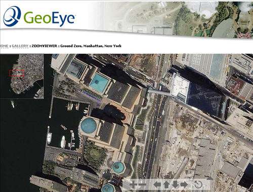
Have you explored some of the imagery available from GeoEye? The company is currently remembering the events of 9/11 by featuring scenes captured using the IKONOS satellite. Recall, at that time, because all air traffic in the United States was grounded, IKONOS was the only resource available that helped show the world the devastation at the site of the collapsed twin towers. GeoEye has made available via their Gallery a very nifty image viewing application where you can explore Lower Manhattan, NY, the devastation caused by Hurricane Katrina, and many other scenes.. check it out.. simply click on the "Gallery" link
Subscribe to:
Post Comments (Atom)
No comments:
Post a Comment