
CARIS Spatial Fusion Enterprise
Originally uploaded by @gletham GIS, Social, Mobile Tech Images
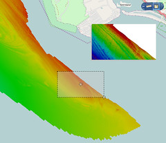
The latest release of Spatial Fusion Enterprise is building on its support of Open Geospatial Consortium (OGC) standards by implementing the Web Coverage Service (WCS) standard for bathymetric data. Using Spatial Fusion Enterprise, to distribute and interrogate bathymetry on the web - see www.gisuser.com/content/view/23308/2/
No comments:
Post a Comment