

Showing posts with label terraserver. Show all posts
Showing posts with label terraserver. Show all posts
November 13, 2007
The Next-Generation USGS Quadsheet in GeoPDF with 37 layers of information
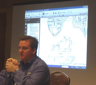
I got the latest on GeoPDF today at the Denver stop of the GeoPDF roadshow from TerraGo Technologies - more on that later. One of the cool things we heard about in a wrap-up was the next version of USGS quads that will be converted to GeoPDFs over the next 5 years. Granted, these daya are currently available as free GeoPDFs from the USGS, however, this next version (the next generation) will add loads more functionality and usefulness to these data. Look for GeoPDF quads to include 37 layers of information (yes, 37!) where the user can toggle on/off any of the layers of information (names, contours, transportation features, etc...) The quads will be searchable and users can query for required strings (like a place name, feature, road name) and these quads will also be color separated... perhaps coolest of all, these GeoPDFs will be easily ingested into ArcGIS! Stay tuned on this! See below for an image showing the next-gen USGS GeoPDF quadsheet as displayed by Jaymes Pardue of TerraGo Technologies. For more information on working with USGS Quadsheet GeoPDFs see this article Locate and Download free USGS GeoPDF maps using the Map Downloader - see also http://store.usgs.gov/locator and http://www.terragotech.com/support


May 22, 2007
Checked out Terraserver Beta yet?
 Just browsing terraserver and hopped over to have a looksee at the new Beta version. Check it out.. search for imagery by address, coordinates, or township. Obviously this version is taking advantage of the recent partnership with mytopo as it's now very simple and evident that you can quickly order prints of the imagery - see http://beta.terraserver.com - if you ever need a cool poster or print of your office, your home, maybe an NFL stadium or ??? this is a great resource to bookmark
Subscribe to:
Posts (Atom)